Mapping and calculation of the shoreline change in selected areas in Tigbauan, Iloilo, Philippines using remote sensing and geographic information systems (GIS) techniques
MAXINNE LOUISE DOMINIQUE L. CO1, TRISHA MARIE A. LUCIDO1, GABRIEL DAX P. AGURA1, ARIS C. LARRODER1, and PAUL CAESAR M. FLORES2
1Philippine Science High School Western Visayas Campus – Department of Science and Technology (DOST-PSHSWVC), Brgy. Bito-on, Jaro, Iloilo City 5000, Philippines
2The Marine Science Institute, University of the Philippines, Diliman, Quezon City 1101, Philippines
Abstract
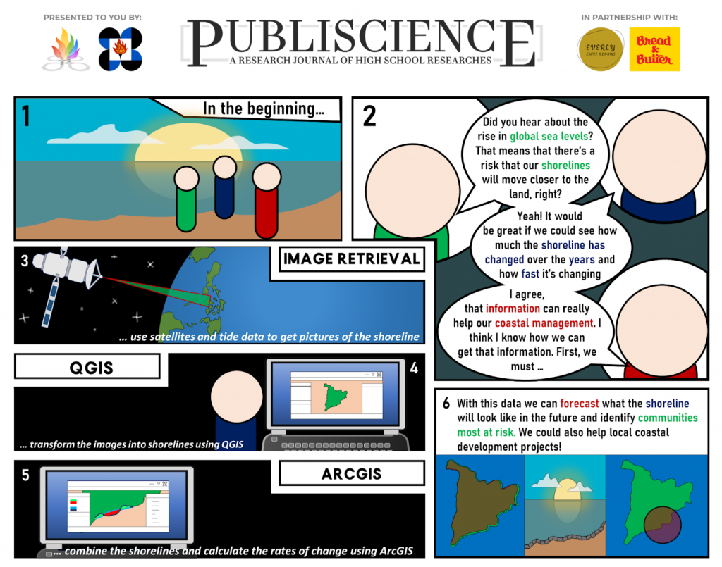
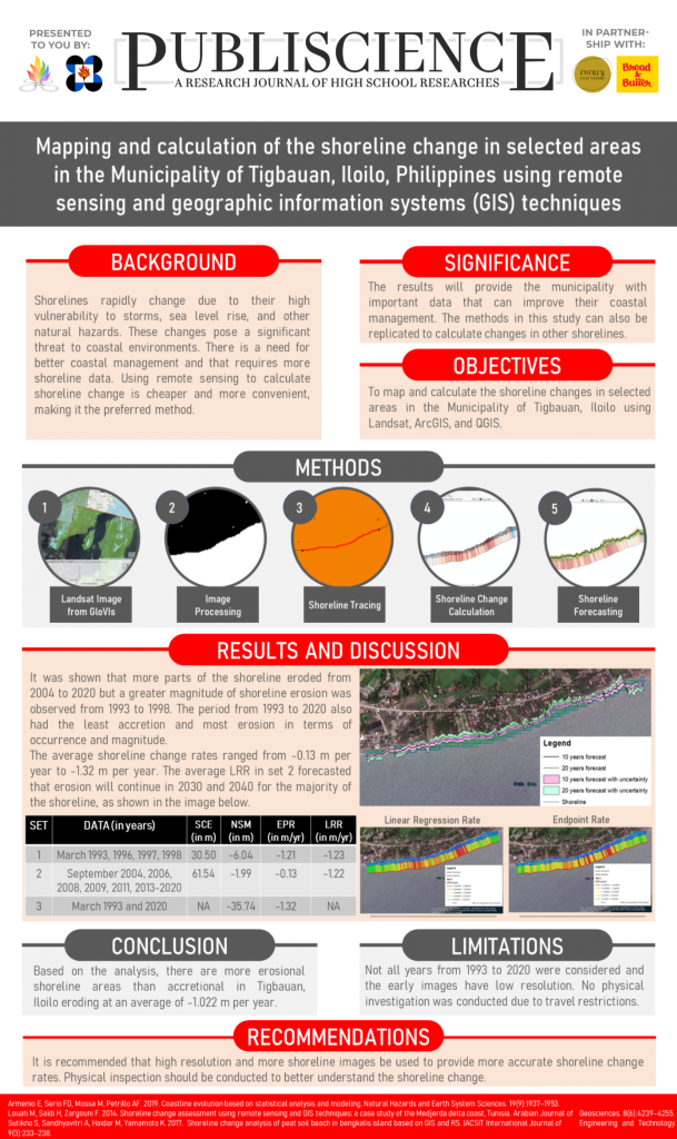
Shoreline change poses a significant threat to coastal environments and is exacerbated by climate change, hence, it should be monitored for better coastal management. This study aimed to determine the shoreline change in Tigbauan, Iloilo using remote sensing and GIS techniques. Eighteen Landsat 5 and 8 images from 1993 to 2020 were obtained using Global Visualization Viewer and processed in Quantum GIS. Shorelines were extracted from processed images and analyzed using the Digital Shoreline Analysis System (DSAS) in ArcGIS by calculating the net shoreline movement, shoreline change envelope, endpoint rate, and linear regression rate. Results showed that from 1993 to 2020, erosion had greater magnitude, rates, and occurrences than accretion. The average rate was -1.022 m per year and erosion was forecasted for most areas in 2030 and 2040. The results can help the government mitigate shoreline erosion risks and methods can be extended to other shorelines.
Keywords: shoreline change, coastal vulnerability, remote sensing, satellite imagery, GIS techniques

